Iguazu Falls
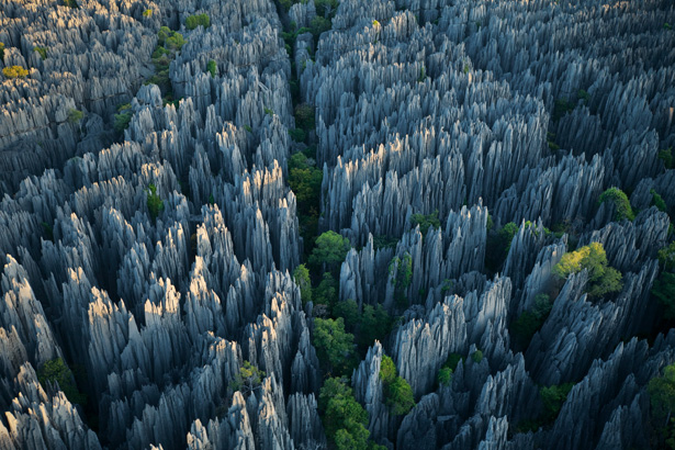
Bemaraha National ParkIUCN category II (national park)
Tsingy de Bemaraha Strict Nature Reserve.jpg
A karst limestone formation, known as tsingy in Malagasy
Map showing the location of Bemaraha National Park
Location of Bemaraha National Park
Location Western Madagascar
Nearest city Morondava, Antsalova
Coordinates 18°40′0″S 44°45′5″ECoordinates: 18°40′0″S 44°45′5″E
Area 666 km²
Established 1997
Visitors approx. 6000 (in 2005)
Governing body Parcs Nationaux Madagascar - ANGAP
UNESCO World Heritage Site
Official name: Tsingy de Bemaraha Strict Nature Reserve
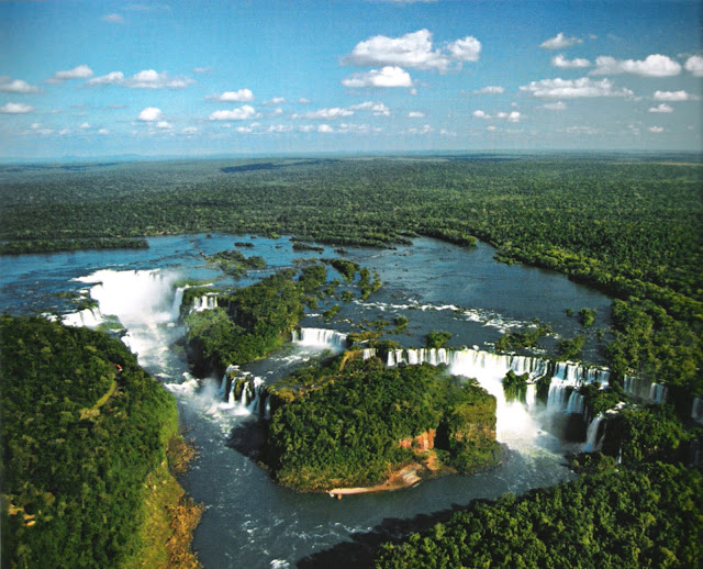
Iguazu Falls, Iguazú Falls, Iguassu Falls or Iguaçu Falls (Portuguese: Cataratas do Iguaçu [kataˈɾatɐz du iɡwaˈsu]; Spanish: Cataratas del Iguazú [kataˈɾatas ðel iɣwaˈsu]; Guarani: Chororo Yguasu [ɕoɾoɾo ɨɣʷasu]) are waterfalls of the Iguazu River on the border of the Brazilian state of Paraná and the Argentinian province of Misiones. The falls divide the river into the upper and lower Iguazu. The Iguazu River rises near the city of Curitiba. The river flows through Brazil for most of its course, although most of the falls are on the Argentine side. Below its confluence with the San Antonio River, the Iguazu River forms the boundary between Argentina and Brazil.
The name "Iguazu" comes from the Guarani or Tupi words "y" [ɨ], meaning "water", and "ûasú "[waˈsu], meaning "big".[2] Legend has it that a god planned to marry a beautiful woman named Naipí, who fled with her mortal lover Tarobá in a canoe. In rage, the god sliced the river, creating the waterfalls and condemning the lovers to an eternal fall.[2] The first European to find the falls was the Spanish conquistador Álvar Núñez Cabeza de Vaca in 1541.
On November 11 of 2011, Iguazu Falls was announced as one of the seven winners of the New Seven Wonders of Nature by the New Seven Wonders of the World Foundation.
source:wikipedia


